IPCC 2021 – Which Regions have been affected the most by climate change?

“A.3 Human-induced climate change is already affecting many weather and climate extremes in every region across the globe. Evidence of observed changes in extremes such as heatwaves, heavy precipitation, droughts, and tropical cyclones, and, in particular, their attribution to human influence, has strengthened since AR5”1

Consider the three following maps with your students, or alternatively focus in on one of the maps.

Heavy Precipitation

“A.3.2 The frequency and intensity of heavy precipitation events have increased since the 1950s over most land area for which observational data are sufficient for trend analysis (high confidence), and human-induced climate change is likely the main driver. Human-induced climate change has contributed to increases in agricultural and ecological droughts in some regions due to increased land evapotranspiration (medium confidence).”1

IPCC precipitation

Source: Adjusted from IPCC 1

  1. Study carefully the map above which shows an assessment of the observed change in heavy precipitation across the globe.
  2. How many of the regions showing on the map have experienced an increase in heavy precipitation?                                                                                                                                                            
  3. How many of the regions shown on the map have experienced a decrease in heavy precipitation?                                                                                                                                                            
  4. What is the situation in the region where you live with regards to changes in heavy precipitation?                                                                                                                                                            
  5. Identify the region where there is high confidence in the human contribution to the observed change.                                                                                                                                                            
  6. Use TEA (Trend, Evidence, Anomoly) to describe the patterns shown on the map above. Which regions have had an increase in observed heavy precipitation? Which regions have limited evidence?                                                                                                                                                                                                                                                                                                                                                                                                                                                                                                                                                                                                                                                                                                                                                                                               
  7. Suggest what impacts an increase in heavy precipitation might have.                                                                                                                                                                                                                                                                                                                                                                                                                        
  8. Look closely at the areas that have limited data and/or literature. Can you suggest reasons why these areas have limited data and literature in relation to heavy precipitation?                                                                                                                                                                                                                                                                                                                                                                                                                                                                                                                                                                                                                                    

Hot Extremes

“A.3.1 It is virtually certain that hot extremes (including heatwaves) have become more frequent and more intense across most land regions since the 1950s, while cold extremes (including cold waves) have become less frequent and less severe, with high confidence that human-induced climate change is the main driver14 of these changes. Some recent hot extremes observed over the past decade would have been extremely unlikely to occur without human influence on the climate system. Marine heatwaves have approximately doubled in frequency since the 1980s (high confidence), and human influence has very likely contributed to most of them since at least 2006.” 1

IPCC hot extremes

Source: Adjusted from IPCC 1

The IPCC define an extreme weather event as “an event that is rare at a particular place and time of year. Definitions of rare vary, but an extreme weather event would normally be as rare as or rarer” than the top or bottom 10% of observed events. Therefore, for hot extremes these would be periods where temperatures are in the top 10% for that region. 1

  1. Study the map above carefully which shows an assessment of the observed change in hot extremes across the globe.
  2. How many of the regions showing on the map have experienced an increase in hot extremes?                                                                                                                                                                                                                                                                                                                        
  3. How many of the regions shown on the map have experienced a decrease in hot extremes?                                                                                                                                                                                                                                                                                                                        
  4. What is the situation in the region where you live with regards to changes in hot extremes?                                                                                                                                                                                                                                                                                                                        
  5. Identify the region where there is high confidence in the human contribution to the observed change.                                                                                                                                                            
  6. Describe the patterns shown in the regions that have had an increase in observed hot extremes.                                                                                                                                                                                                                                                                                                            
  7. Suggest what impacts an increase in hot extremes might have.                                                                                                                                                                                                                                                                                                                                                                                                                                                                                                                                                                                                                                                
  8. Look closely at the areas that have limited data and/or literature on both the hot extremes and heavy precipitation maps. There are more regions with limited data on the heavy precipitation map.  Can you suggest reasons why?                                                                                                                                                                                                                                                                                                                                                                                                                 

Agricultural and Ecological Drought

“A.3.5 Human influence has likely increased the chance of compound extreme events18 since the 1950s. This includes increases in the frequency of concurrent heatwaves and droughts on the global scale (high confidence)”1

IPCC drought

Image source: Adjusted from IPCC 1

The IPCC define Drought as “A period of abnormally dry weather long enough to cause a serious hydrological (water) imbalance.”1 This would mean that the amount of rain that falls is not sufficient to meet agricultural (farming) or ecological (the plants and animals in a region) needs and during the growing season impinges on crop production or ecosystem function.

  1. How many of the regions showing on the map have experienced an increase in agricultural and ecological drought?                                                                                                                                                            
  2. How many of the regions shown on the map have experienced a decrease in agricultural and ecological drought?                                                                                                                                                            
  3. Identify the two regions where there is medium confidence in the human contribution to the observed change.                                                                                                                                                                                                                                                                                                                        
  4. What is the situation in the region where you live with regards to changes in agricultural and ecological drought?                                                                                                                                                                                                                                                                                                                                                                                                                                                
  5. Describe the patterns shown in the regions that have had an increase in observed agricultural and ecological drought.                                                                                                                                                                                                                                                                                                                                                                                                                                                                                    
  6. Suggest what impacts an increase in agricultural and ecological drought might have.                                                                                                                                                                                                                                                                                                                                                                                                                                                                                                                                                                                                                                                                                                                                                                                                            
  7. Look closely at the areas that have limited data and/or literature. Can you suggest reasons why these areas have limited data and literature in relation to agricultural and ecological drought?                                                                                                                                                                                                                                                                                                                                                                                                                                                                        

Overview – Which Regions have been Affected the Most?

IPCC extreme weather overview
Source: Adjusted from IPCC 1
  1. Using the graphic above identify three places but are affected negatively by all three situations [hot extremes, heavy precipitation, and agricultural and ecological drought]
    1.                                                                       
    2.                                                                       
    3.                                                                       
  2. Using the graphic identify an area that that is affected by fewest of the situations?                                                                                                                                                            
  3. Which areas on the map should be a priority for further research into the effects of climate change? Explain your answer.                                                                                                                                                                                                                                                                                                
  4. Which of the three situations have affected most regions of the world? Use evidence from the maps to support your answer.                                                                                                                                                                                                                                                                                                                                                                                                                                                                                                                                                                                                                                    
  5. Write a letter to your local MP, use evidence from the graphic to justify the need for action on climate change. You should focus upon the urgent need for action and how that can be implemented (done) locally.

Geographical information systems activity

Visit the website below, it is the Intergovernmental Panel on Climate Change’s Interactive Atlas. IPCC WGI Interactive Atlas Click on the regional information button, it will bring up an interactive map. Complete the table below using information from the map. You will need to use the menu tools above the map, changing the variable and scenario. Complete this for the Near Term. If you finish, you could repeat for the Long Term on a new sheet and then compare results.
IPCC extreme weather table

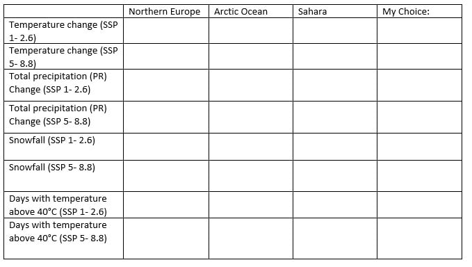
Overall what does the table and map show you about global climates in the future?                                                                                                                                                                                                                                                                                                                                                                                                                                                                                                                                                                                                                                                                                                                                                                                                                                                                                                                                                                                                                                                                                                                                                                                                                                                        

Note 

  • SSP1-2.6: Global CO2 emissions are cut severely, but not as fast, reaching net-zero after 2050. Temperatures stabilize around 1.8°C higher by the end of the century.
  • SSP5-8.5: Current CO2 emissions levels roughly double by 2050. The global economy grows quickly, but this growth is fuelled by exploiting fossil fuels and energy-intensive lifestyles. By 2100, the average global temperature is a scorching 4.4°C higher.

Sources:

  • IPCC, 2021: Climate Change 2021: The Physical Science Basis. Contribution of Working Group I to the Sixth Assessment Report of the Intergovernmental Panel on Climate Change [Masson-Delmotte, V., P. Zhai, A. Pirani, S.L. Connors, C. Péan, S. Berger, N. Caud, Y. Chen, L. Goldfarb, M.I. Gomis, M. Huang, K. Leitzell, E. Lonnoy, J.B.R. Matthews, T.K. Maycock, T. Waterfield, O. Yelekçi, R. Yu, and B. Zhou (eds.)]. Cambridge University Press. In Press. P.11. Accessed 28th November 2021 at Sixth Assessment Report (ipcc.ch)
Climate Change Quality Mark Content

Where is Climate Change most Apparent?

Royal Geographical Society
Climate Change Quality Mark Content

This is a data skills exercise linked to FAQ1.2 of the sixth assessment IPCC report of 2021. The aim of this resource is to answer the question: to what extent do impacts of climate change vary around the world? which you should be able to answer at the end of this resource. It was written with the Royal Geographical Society with IBG

Temporal change

Weather and climate are two separate phenomena that change over time. Read about the distinction on the Met Office webpage So what is weather, and what is climate?

  1. Robert Heinlein said, ‘climate is what you expect, weather is what you get’. What did he mean?
  2. What could you say about the climate over the last 10-years? 70-years? Go to the NASA webpage Climate Change: How Do We Know? to use evidence in your answer.

Imagine you had been monitoring land surface temperatures at the same location for the past 70 years. Consider what, if any, changes would have been recorded.

  1. The UK is a mid-latitude country in the northern hemisphere. Use Table 1 to draw a line graph for UK temperature since 1950. Have average annual temperatures increased in the UK since 1950? Your x axis should range from 1950 to 2020, and your y axis should range from -20°C to 25°C.
iceberg

Figure 1 a melting glacier in Scoresby Sound, Greenland © Andy Brunner. For more on Icelandic climate change watch After Ice

a) Is a line graph an appropriate graph?

b) What is the disadvantage of using annual mean data?

Spatial change

Varying changes to climate are becoming more apparent between geographic locations. The largest long-term warming trends have been recorded in the high northern latitudes e.g., Siberia, Iceland, Alaska and Canada, and the smallest warming trends over land are in Tropical regions.

4. Canada is a predominantly high latitude country in the northern hemisphere. Quantify the latitude range for a low-latitude, mid-latitude, and high latitude country.

5. Use Table 2 to add another line onto your graph charting average annual temperature for Canada.

6. India is a low-latitude country in the northern hemisphere. Use Table 3 to add a line onto the line graph charting average annual temperature for India.

7. Which country has experienced the greatest level of climate change: the UK, Canada, or India?

8. Explain why one country is experiencing greater warming than the others? Research different sources of evidence, such as Arctic Amplification and this article why is the Arctic warming faster than other parts of the world?

Canada regions

Figure 2 capital cities of Canada’s provinces and territories © WorldAtlas.com

It is important to appreciate that changes can occur locally within countries. These changes are on a smaller spatial scale and are often masked by country-to-country comparisons.

Alert in Nunavut, Canada, is the most northern continuously inhabited place on Earth. Lytton is in the southwestern province of British Colombia.

9. Use Table 4 and 5 to add the data onto your line graph from the Alert and Victoria weather stations.

a) Is there climate change variation in Nunavut (the Alert weather station)?

b) Is there climate change variation in British Colombia (the Lytton weather station)?

c) Which location has seen the greatest level of climate change between 1950 and 2020?

Further work

Access the following resources for suggested further work on where climate change is most apparent.

Exam-style question

Using all the work you have completed answer the final question below. The instruction to what extent means you must form and express a view as to the validity of a statement after examining the evidence available and different sides of an argument.

For further help access the Show Your Stripes website from the University of Reading. Select your region and country.  

10. To what extent does climate change vary around the world?

Appendix A

data

Answers

  1. Robert Heinlein conveyed the unexpected nature of weather, and its changeable behaviour over the short-term.
  2. Over the last 70-years the climate has changed dramatically due to an increase in the greenhouse effect. For millennia carbon dioxide (CO₂) had never risen above the 300 ppm (parts per million) but in 2015 atmospheric CO₂ concentration crossed the 400 ppm threshold, an unprecedented moment in the history of modern humans on this planet. Most of the warming has occurred in the past 40 years. The last decade, the 10 years to the end of 2019, have been confirmed as the warmest decade on record by three global agencies.
  3. As instructed.
  4. Low-latitude countries are found between the Equator 0° and 30° north and south. The mid-latitudes are found between 30° and 60° north and south. High latitude is between 60° north and south and the poles.
  5. As instructed.
  6. As instructed.
  7. From your graph it should be clear that between 1950 and 2020, the UK warmed by 1.32°C, whilst India changed by 1.37°C. Canada has experienced the greatest level of climate change with 2.41°C of warming. A source for comparison for your answers is the Met Office Climate change in the UK
  8. This is because Canada is a high northern latitude country. For more information search (Ctrl +F) ‘high latitude’ in chapter 3 of the IPCC report executive summary. The text explains that large and widespread differences are expected regionally for temperature extremes. Extracts from the chapter include:
  • Hot extremes are expected to occur at mid-latitudes in the warm season with increases of up to 3°C for 1.5°C of global warming, and 4°C for 2°C of global warming (a factor of 2)
  • At high latitudes greater extremes are predicted. In the cold season increases of up to 4.5°C at 1.5°C of global warming are expected, and 6°C for 2°C of global warming (a factor of 3)
  • The strongest warming of hot extremes is projected to occur in central and eastern North America, central and southern Europe, the Mediterranean region (southern Europe, northern Africa, and the Near East), western and central Asia, and southern Africa
  • Whilst the number of exceptionally hot days are expected to increase the most in the tropics, where interannual temperature variability is lowest. Extreme heatwaves are projected to emerge earliest in these regions and will become widespread there at 1.5°C global warming

The reason why the Arctic in particular is recording record temperature rises is due to the loss of Arctic sea-ice. When white, bright and reflective sea ice melts it exposes the darker ocean beneath. This amplifies the warming trend because the ocean absorbs more heat from the sun, which causes further melting. Loss of Arctic sea-ice is described as a positive feedback loop (of accelerating decline) and, ultimately, a tipping point for planet Earth.

  1. There is a large climate variation both within these Canadian provinces and between them.a) The Alert weather station has recorded temperature variation with a warming of 3.5°C. b) The Lytton weather station has seen temperature variation with a warming of 2.4°C. c) The Alert weather station has a temperature average of -17.4°C whilst Lytton has 9.4°C. When temperature change is compared between 1950 and 2020, the Alert weather station has experienced the greater level of variability. This shows climate change does vary around the world, indeed even within countries. It also adds further evidence to the argument that climate change is occurring faster in high-latitude regions.
  2. As instructed.
MetLink - Royal Meteorological Society
We use cookies on this site to enhance your user experienceBy clicking any link on this page you are giving your consent for us to set cookies. More info

By clicking any link on this page you are giving your consent for us to set cookies. More info