Over the weekend, we saw Arctic Maritime air descend over the UK, with temperatures dropping by around 10C.
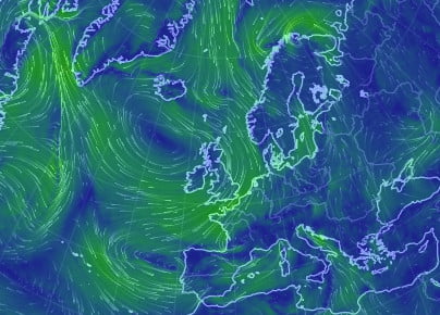
The following snapshot from http://earth.nullschool.net from the morning of Monday 11th May, shows winds blowing clockwise around a High pressure area to the northwest of the UK. This means a northerly air flow over much of the UK, swinging round to easterlies over southern counties.
We can see in these charts from the preceding weekend how the polar front (shown as a cold front) swept down across the UK. This first chart shows 6am on Sunday 10th May, with the cold air over Scotland, Northern Ireland and some of northern England.
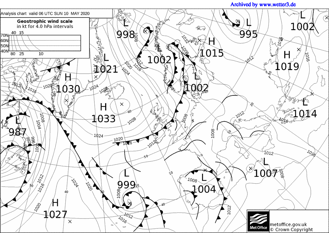
The second chart shows midnight on Monday 11th May – cold air now covers the whole of the UK.

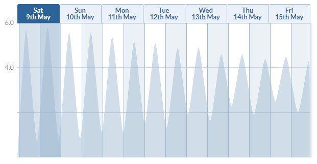
Observations show the temperatures plummeting as the cold front passed, moving us into Arctic maritime air – these observations are from Reading University’s weather station, showing both a week and a 2 day view:
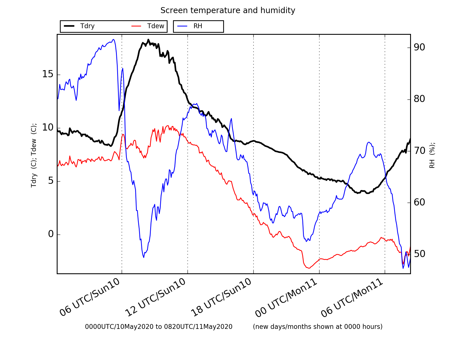
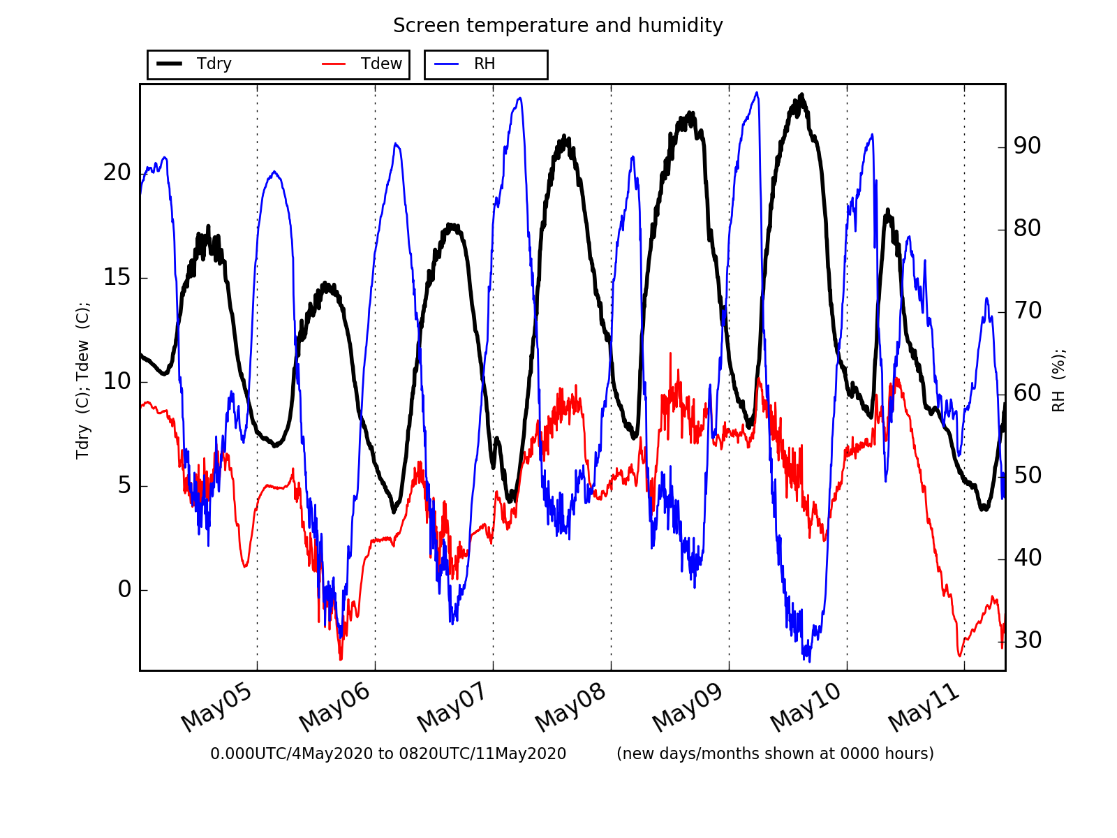
Temperatures clearly drop from around 19C on Sunday morning to 12C by lunchtime, and below 5C overnight. This temperature drop was later further south in the country, and earlier further north. The following graph corresponds to the same time period as the Reading data, but shows data from the Whitworth observatory in Manchester (with thanks to Michael Flynn):

The northerly winds, funnelling surface waters down the North Sea, came at the same time as a Spring tide – the following image is taken from tidetimes and shows the tide height at Whitby. Spring tides are marked by a greater tidal range – higher high tides, and lower low tides.
This led to extremely high tides – and the Thames Barrier was closed overnight to protect London from flooding. A flood alert was issued by the Environment Agency for the South Devon coast.
To make this case study memorable for students, it could be linked to Boris Johnson’s speech at 7pm (18UTC) on the evening of Sunday 10th.