

11. Hot Deserts
In this lesson we look at the characteristics and locations of hot deserts and the adaptations of animals and vegetation found there.

Ecosystem Feedbacks from Carbon and Water Cycle Changes
Questions to consider:State three factors which would cause a change to the Amazonian Forest Ecosystem.Explain the impact of the change to the Amazonian Forest EcosystemWhen

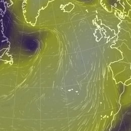
Case Study – Hurricane Igor (Sept 2010)
A Met Office forecaster was working on secondment in Bermuda during
hurricane Igor. Some thoughts were gathered from somebody who experienced
it in person.
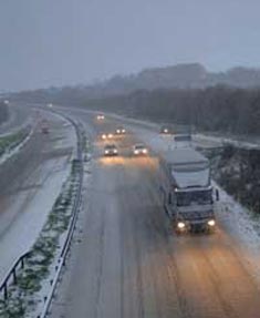
Case Study – Bodmin Snow
A snowy day in Winter 2005 Heavy snow stops traffic on main route through Cornwall. Traffic moving on snowy road. Traffic Jam on A30 More