Air Masses
Air masses and fronts – introductory text
Air Masses – an introduction to the major air masses affecting the UK
Case studies of UK air masses (November 2010, November 2011 and the end of September 2010) with answers for teachers and a case study of arctic maritime air (Jan/ Feb 2015) can be found on our case studies page.
Air Masses – worksheet and the Met Office’s air mass video .
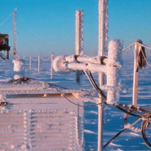
AWS data to study air masses and depressions (adapted from LGfL)
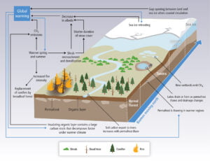
Past Climate Change
Resources to teach the climate of the last 2.6 million years.
Climate negotiations resource:
https://www.youtube.com/watch?v=Cn-ZqGJxpk4&
Rainfall
A case study of orographic rainfall in Scotland with images for students Image 1, Image 2, Image 3, Image 4, Image 5.
Weather Systems and Synoptic Charts
An introduction to weather systems
Anticyclones, depressions and fronts
Understanding weather charts – excercises
Weather systems plenary, revision or homework exercise – an investigation into why the forecast showed the temperature rising at night.
What is the weather? Work out what the weather is like at several UK locations based on some simplified weather maps.
Isotherm and Isobar drawing exercise based on a depression: student worksheet. A simpler version of the T/ isotherm map can be found here or the full version including solutions may be found on the A level page.
Using WOW data to investigate a depression passing across the UK with worksheets for students
Use WOW data to track a cold front across the UK and work out its speed.
Weather Maps – basic information on synoptic charts, with Isotherm map excercise and Synoptic chart excercise.
We’ve pulled together some resources about ex-hurricane Ophelia, bringing together information about tropical cyclones, depressions, anticyclones and air masses to explore the extremely unusual weather we experienced in October 2017 Ophelia.pptx.
Tropical Weather
Using GIS to study hurricane tracks and tropical storm risk (developed by Bob Lang, teacher and GA consultant)
Some useful links about Super typhoon Haiyan/ Yolanda
Other Weather
Urban Heat Island Fieldwork and a simple and effective lesson plan which uses WOW data to identify Urban Heat Islands. The supporting PowerPoint presentations can be found here.