Climate Change Schools’ Project Resources

craft modelThe Climate Change Schools Resources were developed by the Climate Change Schools Project, based at the then Science Learning Centre in Durham and led by Krista McKinzey. A large number of teachers and schools in North East England were involved in their development.

They have subsequently been updated by the Royal Meteorological Society.


Climate Change Teaching Resources for Schools

Resources for KS2/ upper primary

Resources for KS3 (some can also be used at KS4/ GCSE)

Resources for A level/ more advanced students and teacher CPD


Climate Literate person;

  • Understands the essential principles of Earth’s climate system and knows how to assess scientifically credible information about climate,
  • Communicates about climate and climate change in a meaningful way,
  • Can make informed and responsible decisions with regard to actions that may affect climate.

Country Background Information: Venezuela

Home » Teaching Resources » Secondary » 11 to 14 » Page 20

Country Background Information: Venezuela

Facebook
Twitter
Pinterest
Print
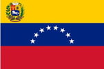
Venezuelan flag
Venezuela

If possible, download these two documents to your phone, so that you can refer to them later:

Key country facts

Glossary

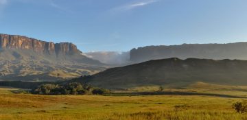
canaima mountains

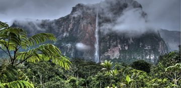
Canaima National Park in the southeastern part of Venezuela is a 3 million ha UNESCO world heritage site. 65% of the park is covered by mountain formations bordering Brazil and Guyana. The park has an equatorial climate with as much as 4,000 mm of rainfall every year. Source: Photo by Paolo Costa Baldi / License: GFDL/CC-BY-SA 3.0

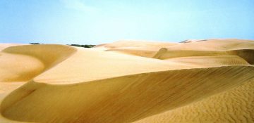
Sand Dunes

Sand dunes up to 40m high can be found in Medanos de Coro on the north coast of Venezuela. Source: Flickr / SarahTz

oil barrels

Venezuela has the largest proven oil reserve in the world. 99% of its export earnings are from oil, contributing largely to the national income. Changes in oil prices have a massive impact on Venezuela’s economy. In addition, oil production has fallen rapidly since 2012 following sanctions from the US government, who were the main importer. Source: Flickr / L.C. Nøttaasen

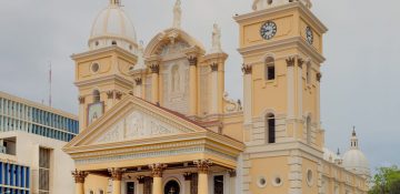
church

The over 300-year old Basilica de la Chinita is one of the most popular churches in Maracaibo City. 96% of Venezuela’s population is Catholic. Source: Wikimedia Commons / Wilfredo Rodriguez

caracas

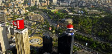
Caracas is the largest city and capital of Venezuela. 89% of Venezuela’s population live in urban areas. With the current economic and political situation, major cities like Caracas experience food shortages. This brings further challenges in terms of health and other social services. Source: Wikimedia Commons / Paulino Moran

coffee plant

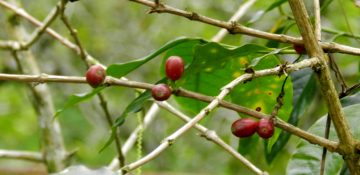
Coffee is one of the main crops grown in Venezuela and used to be a major export. Venezuela now imports 70% of its food and agricultural products – including coffee. However, the decline in profits from the oil industry has led to food shortages, corruption and food not reaching the poor. 12% of Venezuelans are malnourished. Source: Wikimedia Commons / Juan Carlo Castillo Ortega

rain forests

More than half of Venezuela is covered by forests. Since 1999, Venezuela has gone from a country where deforestation and land use change accounted for considerable greenhouse gas emissions, to one where the forests are absorbing greenhouse gases. Source: Flickr / Iñaki Lopez

dam

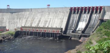
Venezuela’s hydroelectric schemes currently meet 70% of its electricity needs. However, this is highly dependent on rainfall. During El Niño events, where there is far less rainfall, power cuts become frequent. Power cuts can lead to drinking water shortages. Source: Wikimedia Commons / Fadi

beach

Venezuela has a rich terrestrial and marine biodiversity and therefore has a wide variety of ecosystems vulnerable to climate change. Source: Wikimedia Commons / Berrucomons

migrants

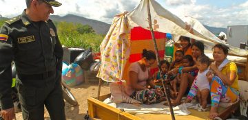
Venezuela has been in a socioeconomic and politial crisis since 2010. 94% of people live in poverty. Starvation, disease and poverty have led to over 3 million people leaving the country. One quarter of Venezuelans need humanitarian aid. Source: Wikimedia Commons/ National Police of Colombia

Country Background Information: USA

Home » Teaching Resources » Secondary » 11 to 14 » Page 20

Country Background Information: USA

Facebook
Twitter
Pinterest
Print
USA flag
USA

If possible, download these two documents to your phone, so that you can refer to them later:

Key country facts

Glossary

traffic

With more than 270 million cars and trucks, the USA’s transport sector is the second largest contributor (29%) to the country’s greenhouse gas emissions. Over 90% of these vehicles use petroleum-based fuel.

miami

Florida is surrounded by the Atlantic Ocean and the Gulf of Mexico. Because of its coastal location, many cities in Florida are vulnerable to rising sea levels. This means that it is at risk of more frequent and intense flooding, erosion and saltwater intrusion which can affect agriculture, water supply and the natural environment.

Hurricane Katrina

Hurricane Katrina hit the south-eastern part of the USA in August 2005. It was the costliest natural disaster to hit the USA ever and resulted in 1,245 deaths. It is predicted that the wind speeds and rainfall associated with tropical cyclones will increase in a warming world.

Yellowstone

Established in 1872, Yellowstone National Park was the first national park in the world. Its 9000km2 land area goes across three states: Wyoming, Idaho, and Montana. It is also home to many wildlife including 67 species of mammals, and over 300 species of birds.

Oil Drilling

More than half of US oil output is now extracted through fracking. This boosted oil industry production from 102,000 barrels of oil per day in 2000 to 12.5 million barrels per day in 2019. However, the process of fracking has resulted in large number of oil spills which can cause environmental damage. Source: Flickr / Tim Evanson

Whitehouse

The transition from President Obama to President Trump has marked a significant change in the country’s position on climate change. In 2016, Obama agreed to sign the Paris Agreement to legally bind the USA to reduce its carbon emissions. In 2019, the USA began to withdraw from the agreement. However, 23 states have formed the United States Climate Alliance and committed to meet or exceed the targets of the Agreement.

Black Friday Sale

Consumer spending continues to rise in the USA. An average household spends about $60,000 or about £49,000 per year. Although high consumption is economically good, it puts pressure on natural resources where products are made and generates waste. Source: Flickr / Diariocritico de Venezuela

tornado

More than 1,200 tornadoes develop across the US every year. Most of them occur in the Southern states bordering the Gulf of Mexico such as Texas, Kansas, and Florida. The damage caused by tornadoes could increase as the climate warms. Source: Flickr / Lane Pearman

wheat Fields

Wheat is the third most grown field crop in the USA after corn and soybean but has been declining. The U.S. share of global wheat exports have gone down from 25% in 2005 to 15% in 2016. Research shows that rising temperatures have contributed to a decline in wheat production. Source: Flickr / Tobin

Drought

California’s hot and dry climate leads to frequent droughts. Recently, droughts have become more extreme with record-high temperatures and record-low levels of precipitation. This impacts water supply and water quality, wildlife, wild fires and agriculture. In an extreme drought event in 2016, some reservoir levels were at 10% of normal capacity. Source: Flickr / Linda Tanner

Country Background Information: Russian Federation

Home » Teaching Resources » Secondary » 11 to 14 » Page 20

Country Background Information: Russian Federation

Facebook
Twitter
Pinterest
Print
Russian flag
Russian Federation

If possible, download these two documents to your phone, so that you can refer to them later:

Key country facts

Glossary

snowy mountains

The climate of Russia is continental, with hot, dry summers and extremely cold winters – particularly in Siberia. The Western parts of the country have the most rain. During winter, snow cover lasts from 60 to 80 days in the south and from 260 to 280 days in the far North.

oil rig

Russia is the world’s third largest oil producer. Because of its large oil and gas industry, Russia has a high-emission and energy-inefficient economy.

Moscow

Moscow is the capital city of the Russian Federation, the largest country in the world by land area, which spans 11 time zones and accounts for 1/8 of the world’s land area. 78% of its population live in European Russia.

mining

Russia has extensive gas, coal and oil reserves. 87% of the energy Russia consumes comes from fossil fuels. Russia is also the world’s second largest producer of hydroelectricity. Other renewable energy sources are largely undeveloped although it has the potential for them.

The Kremlin

The Russian Federation, commonly known as Russia, emerged when the Soviet Union broke up in 1991. Russia has ratified the 2015 Paris Climate Agreement.

Tundra

Vast areas of northern Russia are covered in tundra, where the ground remains frozen and precipitation is very low. Recent changes in weather have resulted in milder winter temperatures, affecting not only pasture for reindeers but also the movement of the indigenous peoples of the arctic tundra. As the tundra warms, there are complex changes to the local carbon cycle. Source: Flickr / Ninara

Sea Vessel in Ice

Russia is warming 2.5 times faster than other parts of the world. Increases in temperature have caused a decline in the Arctic sea ice. This opens up shorter trade routes which could potentially benefit the Russian and global economy. Ships are a major emitter of greenhouse gases. Source: Flickr / Christopher Michel

Manhole

Russia has the longest hot water and district heating network in the world. Heating for houses and hot water is centrally provided through an inefficient pipe network from local heat generation plants. There are no heating controls in many older houses apart from opening the window. Source: Flickr / Vera

countryside

13% of Russia is classified as agricultural land, but only 7% of it is cultivated. Since 2000, the country has become a major grain exporter. Russia has introduced laws restricting the import of food from many countries. Source: Wikimedia Commons / Sergey Ashmarin

St Basil Moscow

The Cathedral of Vasily the Blessed, commonly known as Saint Basil’s Cathedral, is a 16th century church in the Red Square in Moscow, Russia and a major tourist attraction. Orthodox Christianity is the main religion in Russia, but Islam, Buddhism and Judaism are also important

Country Background Information: Australia

Home » Teaching Resources » Secondary » 11 to 14 » Page 20

Country Background Information: Australia

Facebook
Twitter
Pinterest
Print
Australian flag
Australia

If possible, download these two documents to your phone, so that you can refer to them later:

Key country facts

Glossary

great barrier reef

Off the north east coast of Australia is the Great Barrier Reef – the world’s largest coral reef system covering 344,400 km2. The Reef is home to more than 2000 species of corals and fish and other marine animals such as whales, dolphins, sharks, and rays. However, continuous increases in ocean temperatures have caused more than 60% of the corals in the Great Barrier Reef to bleach. 25% are severely bleached.

koala

Like kangaroos, koalas are native to Australia. They live in forests and woodlands and feed off leaves of eucalypts. The International Union for Conservation of Nature (IUCN) has recently listed them as Vulnerable because of the impacts of climate change and loss of habitat. 10 000 koalas died in the 2019/ 2020 Australian bushfires.

bondi beach

Because of its size, Australia has a variety of weather and seasons depending on the region. The popular Bondi Beach in New South Wales can be found in the temperate zone, where average summer temperature is between 16 and 26 °C. However, during heatwaves, temperature can reach as high as 48 °C.

aboriginals

Known as the oldest civilization, Aborigines lived in Australia long before the arrival of European settlers in the 1700s. Aboriginal Australians have a very diverse culture – rich with arts, music, and dance. Source: Flickr / Dan Lundberg

gold mine

One of the biggest industry in Australia is mining. It is also a large contributor to the country’s economy. Apart from gold, Australia also mines coal, uranium, iron ore, nickel, bauxite, lead, copper, zinc, mineral sands and diamonds.

Australia city

About 25 million people live in Australia, where 86% reside and work in urban areas. The country also has one of the highest living costs in the world. On average, living costs in Australia are 13% higher than in the UK.

port

Australia is one of the world’s largest coal exporters. Gladstone Port in Queensland exports about 70 million tonnes of coal per year. Coal accounts for 40% of Australia’s energy use and 72% of electricity generation.

sydney opera house

Built in 1973, the Opera House in Sydney is named as one of the most distinctive buildings of the 20th century. It attracts 10.9 million visitors every year.

bush fire

Bushfires are common in Australia because of its generally hot and dry climate, topography and flammable vegetation like eucalypts. Every year, bushfires cause damage to properties and loss of life. Australia’s summer of 2019/20 released more carbon dioxide than Australia does in a year. Bushfires are becoming more common.

royal exhibition hall

The Royal Exhibition building, surrounded by the iconic Carlton Gardens, is the first UNESCO World Heritage Listing in Australia. It was built in 1880 and remains as the only surviving Great Hall for exhibitions.

Country Background Information: Nigeria

Home » Teaching Resources » Secondary » 11 to 14 » Page 20

Country Background Information: Nigeria

Facebook
Twitter
Pinterest
Print
Nigerian flag
Nigeria

If possible, download these two documents to your phone, so that you can refer to them later:

Key country facts

Glossary

lagos

Nigeria has the highest population in Africa. 51% of its population lives in urban areas, an 18% increase over the last 10 years. Half the population of the country lives below the International Poverty Line, driven by ethnic conflict, political instability and income inequality. Source: Flickr / Robert

women

Gender inequality is a major issue in Nigeria. In 2007, 64% of boys and 58% of girls of primary school age were in school. Nigeria has the highest number of children out of school in the world. Source: Flickr / Mark Fischer

drilling

Nigeria is the 13th largest producer of oil in the world. Its oil and gas sector accounts for about 10% of GDP, while petroleum exports revenue represents over 86% of total exports revenue. However, it employs only a tiny fraction of the population and conflict limits productivity. Source: Flickr / e.r.w.i.n.

market

Agriculture and food production is the main source of livelihood and largest economic sector in Nigeria, despite the prominence of the oil industry. Its main crops are rice and cassava, with a heavy reliance on rainfall. Source: Flickr / Andrew Moore

makoko village

Situated on a lagoon in Lagos, Nigeria’s largest city, is Makoko – a floating slum village. This community was a result of population explosion and migration of people into the cities. It has about 250,000 residents. The government is working with them to regenerate the area. Source: Flickr / Rainer Wozny, Heinrich-Böll-Stiftung

villager

There are more rural poor than urban poor. Nigeria has the 5th lowest life expectancy of countries worldwide. Source: Flickr / Rainer Wozny, Heinrich-Böll-Stiftung

waterfall

Nigeria’s unique rainforest is amongst the richest in Africa. The country is also home to numerous important game reserves, such as the Yankari and Kainji national parks. Source: Flickr / Shiraz Chakera

infrastructure

Despite its relatively fast development, infrastructure (e.g. buildings, roads and other communications networks and power supplies) in Nigeria remains inadequate. Nigeria spends about US$6 billion (5% of GDP) per year for infrastructure development, however, the Asian Development Bank recommends that for a developing country to sustain growth, it has to spend at least 6% of its GDP on infrastructure. Source: Flickr / Jollof Malt

cocoa

Cocoa is the main agricultural export of Nigeria. However, production has been declining in the last five years. Apart from policy challenges, cocoa production is sensitive to increase in temperature and reduced rainfall. Source: Flickr / Jollof Malt

desertification

Around two-thirds of the total land area of Nigeria is experiencing desertification. Desertification happens because of high temperatures and low rainfall which results in land being unable to support vegetation or the growth of plants. Source: Flickr / Jeff Attaway

Country Background Information: Maldives

Home » Teaching Resources » Secondary » 11 to 14 » Page 20

Country Background Information: Maldives

Facebook
Twitter
Pinterest
Print
Maldive flag
Maldives

If possible, download these two documents to your phone, so that you can refer to them later:

Maldives

Glossary

tropical beach

Tourism is the main industry in the Maldives. It has 1,190 islands, with 200 inhabited. The availability of drinking water and arable land are its limiting factors. As sea levels rise, salt water can encroach on the lenses of fresh water stored in the ground.

corals

Maldives has one of the richest marine biodiversity in the world. All the islands in the Maldives are atolls or ring-shaped coral islands. In unusually hot weather, coral reefs can become ‘bleached’ when the coral loses the algae that lives within it and provides it with food. In long hot spells, this can lead to the coral dying. Over 60% of its reefs are already bleached. As the climate warms, more bleaching events are predicted.

maldives underwater

Over 80% of the Maldives is less than 1m above sea level. This makes the country very vulnerable to sea level rise. In 2009, the Government held a cabinet meeting under water to highlight its vulnerability. Source: Flickr/ Sindi

mangroves

The Maldives hold a range of coastal ecosystems including coral reefs, seagrass beds, lagoons, beaches and small areas of mangrove. These coastal and marine ecosystems are the asset base of the national economy. For example, tourism is based wholly on the health and attractiveness of Maldives’s coastal features. Source: Wikimedia Commons / Nevit Dilmen

family

The total population of the Maldives is just over 540,000. The number of people living in poverty in the Maldives has fallen rapidly in recent years such that now there is very little. Recent migration to the Maldives from South Asia, Egypt, Russia etc. has been to fill jobs in tourism, construction, health and education sectors. Migrants make up over a third of the population.

male arial photo

Most people live on the capital island, Male. Congestion is an issue. It is the 7th most densely populated island in the world. Source: Flickr / Timo Newton-Syms

cargo boat

Imported oil and diesel are the main power source for the Maldives. The Maldives also imports wood, iron and steel, pre-fabricated buildings, vegetables and cement. Source: Flickr / Mark Fischer

fishmonger

Fishing is the second largest industry in the Maldives. Fish is the dominant export from the islands. Fishing relies on healthy marine ecosystems. Source: Flickr / Mark Fischer

diving

Many tourist resorts are reporting severe beach erosion as sea levels rise. Source: Flickr / Neville Wootton

coconuts

Coconuts are important to Maldives’ agriculture and economy. Coconut production is its main agricultural activity while copra made from coconut palms is one of its top export products. Source: Flickr / Easa Shamih

Country Background Information: India

Home » Teaching Resources » Secondary » 11 to 14 » Page 20

Country Background Information: India

Facebook
Twitter
Pinterest
Print
Indian flag
India

If possible, download these two documents to your phone, so that you can refer to them later:

Key country facts

Glossary

taj mahal

The Taj Mahal is a popular tourist attraction in Agra, India. It is considered to be the greatest example of Indo-Islamic architecture and was listed as a UN World Heritage Site in 1983. Local air pollution can cause discoloration to its centuries-old white marble.

flooding

Over 40 million hectares of India’s land is prone to flooding including its two main cities, Kolkota and Mumbai. As sea levels rise, by 2050 at least 40 million people are expected to be at risk.

monsoon

The monsoon season in India is from June to December. Year to year changes in the monsoon can mean flooding or drought. The impact of climate change on the Indian monsoon is as yet not clear. Source: Flickr / Craig Cloutier

mumbai

India is a rising economic power. Its financial and commercial centre is Mumbai where many of its industry sectors operate. These include electronics, manufacturing, and textile, contributing 25% to India’s industrial output. It is also the richest and most populous city in India. Source: Flickr / Puranjit Gangopadhyay / CIFOR

busy market

Over 1 380 million people live in India and its population continue to grow at a faster pace than China. It is therefore projected that by 2024, it will overtake China as the most populous country in the world. 21% of its population is below the poverty line.

wheat fields

Wheat is one of the main agricultural products of India, cultivated mostly in the Northern region. India is the second top producer of wheat in the world. Despite the existence of big commercial industries in Indian cities, more people (42%) still rely on agriculture for livelihood and employment.

Glacier

The Indian Himalayan glaciers cover around 25,000 km2 of catchment area, flowing in three major river systems. Glacial meltwater is important for reservoirs and river flow. Any change in the ice cover and flow of melting glaciers can significantly affect river systems, potentially impacting water quality and availability, for domestic, agricultural and industrial use. Source: Flickr / Steynard
solar panels

Solar energy is India’s top and fastest growing renewable energy resource. It currently contributes 10% to the country’s energy mix, with a generation capacity of 37 GW. In 2017, solar power became cheaper than power from coal. Source: Flickr / CGIAR

rickshaws

Auto-rickshaws are a popular mode of transportation in Indian cities. In Mumbai alone, there are about 200,000 of them. Air pollution from rickshaws poses health risks. Source: Flickr / Melanie M

Delhi

The Urban Heat Island effect means that many cities, like New Delhi, experience warmer temperatures, particularly at night. The warmest places are usually concentrated in residential, industrial, and commercial zones. Source: Flickr / Francisco Anzola

Country Background Information: European Union

Home » Teaching Resources » Secondary » 11 to 14 » Page 20

Country Background Information: European Union

Facebook
Twitter
Pinterest
Print
European Union Flag
Europe

For the purposes of these negotiations, the 27 countries of the EU are Austria, Belgium, Bulgaria, Croatia, Republic of Cyprus, Czech Republic, Denmark, Estonia, Finland, France, Germany, Greece, Hungary, Ireland, Italy, Latvia, Lithuania, Luxembourg, Malta, Netherlands, Poland, Portugal, Romania, Slovakia, Slovenia, Spain and Sweden.

If possible, download these two documents to your phone, so that you can refer to them later:

Key EU facts

Glossary

EU flag

The European Union is composed of 27 diverse member states. The EU more than met its 2020 target of 20% reduction in greenhouse gas emissions. The European Climate Law sets the 2050 target of becoming the world’s first climate neutral continent. Between 2014 and 2020 the EU committed EUR 14 billion to finance climate change adaptation and mitigation activities in developing countries. Source: Flickr / Thijs ter Haar

Luxembourg

Luxembourg is the second richest country in the world based on income. Only 2 500 km2 in size, its territorial GHG emissions are much lower than other EU countries. However, their per capita emissions are one of the highest in the world due to a more energy-intensive lifestyle.

Paris

One of the most visited European destinations, Paris is also significant as a landmark for climate negotiations. In 2015 at the UNFCCC Conference of Parties, 195 nations agreed to sign the Paris Agreement which aims to “keep the global temperature rise in this century well below 2 degrees above pre-industrial levels” and pursue a limit of 1.5 C.

Croatia

Croatia joined the European Union in 2013; the newest member of the EU. Compared to other EU countries which focus on climate change mitigation, the government of Croatia’s climate change policy is focused on adaptation. Because of its coastal location, around 15% of the country is at risk from flooding caused by rising sea levels and extreme weather events. Source: Flickr / Andrey

BMW HQ

Germany has the largest economy in Europe, powered by its biggest industry–automobile manufacturing. Through improvements in engine efficiency and fuel alternatives, this industry has seen significant reductions in GHG emissions. So far, Germany has managed to reduce its total emissions to 36% below 1990 levels, yet it remains to be the biggest contributor to EU emissions.

Malta

Malta currently has the lowest GHG emission among all EU countries, with only 2 Mt CO2eq. Investment in new generation capacity, fuel switching and alternative sourcing of electricity contribute towards the rapid decrease in emissions since 2012.

wind farm at sea

Denmark generates the highest wind power in Europe. In 2019, more than 47% of the country’s electricity was from wind energy. Denmark also exports wind energy to neighbouring countries. Source: Flickr / Kim Hansen

Olive Trees

Olive oil is one of the top agricultural exports from the EU, providing 67% of the world’s olive oil. Scientists predict that olive yield will be affected as drought and pest infestations increase with climate change.

Nuclear Plant

Nuclear power is significant in France’s energy and economy. Around 75% of France’s electricity is from nuclear power. It is also able to export electricity from nuclear energy, earning them around EUR 3 billion per year. Source: Flickr / IAEA Imagebank

Refugees Welcome Sign

Since 2015, about 2 million refugees have come to the EU. Climate change is expected to cause further migration. The EU recognizes this and has set out policy discussions on how they could support and assist other countries in addressing migration as an adaptation strategy. Source: Flicker / Ilias Bartolini

Country Background Information: China

Home » Teaching Resources » Secondary » 11 to 14 » Page 20

Country Background Information: China

Facebook
Twitter
Pinterest
Print
Chinese Flag
China

If possible, download these two documents to your phone, so that you can refer to them later:

Key country facts

Glossary

great wall of china

The Great Wall is one of the most popular historial attractions in China. Built from 3rd century BC to the 17th century AD as a military defence, the Wall extends to 20,000 km. It is listed as a UNESCO World Heritage Site in 1987.

shanghai

On the central coast of China is its biggest city and financial centre; Shanghai. While the city booms economically, its coastal location makes it vulnerable to extreme weather such as flooding. This threatens infrastructure, people, businesses and other economic activities.

panda bear

Pandas are native to China. Despite being a popular conservation icon, giant pandas remain vulnerable to climate change and habitat destruction.

pollution

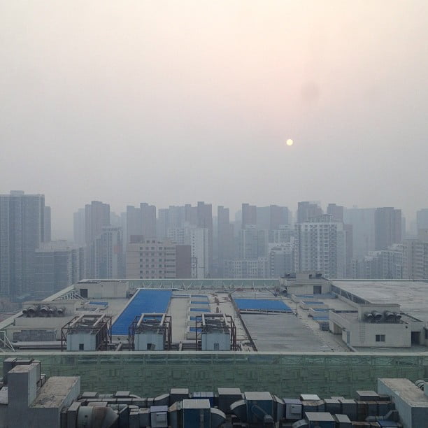
Urban pollution, including haze and smog, is one of the biggest problems in major Chinese cities. This is caused by smoke from the many vehicles, steel factories, and coal-fired power plants. According to recent research, greenhouse gases potentially contribute to the increasing severity and frequency of haze, exacerbating health risks in cities. Source: Flickr / Thomas Galvez

factory workers

Around 30% of China’s population are employed in industry including mining, iron, steel, aluminum, machinery, and textiles. China is the largest exporter of goods in the world. This also makes it the biggest ‘carbon exporter’: it emits a significant amount of greenhouse gas through making goods for other countries. Source: Flickr / Chris

city people

China has the largest population of any country in the world. With over 1 400 million people, about 20% of the world’s population live in China. However, low birth rates due to government policy and personal choice mean their population is ageing rapidly.

power plant

As part of its efforts to reduce air pollution from coal-fired power plants and to shift to non-fossil fuel energy source, China is increasing its investments in nuclear energy. It currently has 45 nuclear power reactors and is building 12 more. Source: Flickr / Shubert Ciencia

cement factory

China’s manufacturing sector contributes about 40% to its GDP. The cement industry in particular, is one of its largest, along with steel and chemical fertilizers. These however are also carbon-intensive industries and are the largest sources of the country’s greenhouse gas emissions. China is the world’s biggest carbon emitter with emissions increasing through 2018 and the first half of 2019. Source: Flickr / Jonathan Kos-Read

gorges dam

The Three Gorges Dam is a hydroelectric dam built along the Yang Tze River. 660 km long with a 22,500 MW capacity, it is the largest power station in the world. Because of social and environmental issues surrounding its construction, it is also considered by campaigners as the most controversial power station. Source: Flickr / Harvey Barrison

rice fields

425 million are employed in agriculture, producing food for 20% of the world’s population. Crops include rice, wheat, potatoes, sorghum, peanuts, tea, millet, barley, cotton and soybeans. About 74% of their total nitrous oxide emissions (a greenhouse gas) come from fertilizer applications.